Geography
Puzzle Maps
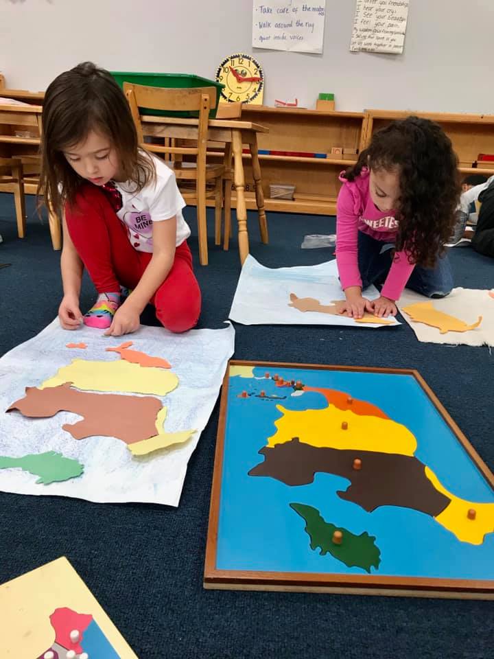
The puzzle maps are quite large wooden puzzles with a knob to remove each piece, which represents a political entity such as a state or a country. These knobs are generally placed at the country or state capitols. There are eight maps. The puzzle map of the world shows the continents and is color coded to a small globe so that the child can see the relationship between a piece on the map and its position on the globe. Each continent is then presented as a separate map with its individual countries. Generally, Australia is presented first as the simplest and Africa is presented last as the most difficult. The United States is the only map of a country with its individual states.
The purpose of the puzzle maps changes as the child matures. The beginning student loves them for the sensorial aspects. Taking out the pieces and placing them back in their frame appeals to the love of order. A very young child may need assistance to carry the maps, as they tend to be large and heavy to a 3-year-old. He learns grace and courtesy as he requests help from a classmate. The more mature child learns concentration and fine motor skills as he pricks individual pieces for the map he is constructing. The parent’s appreciation for the finished map reaffirms the worth of the child’s work. As the child matures and begins to appreciate a more global view, his absorption of facts will serve him well as he recalls them in his elementary education.
There are many variations for the puzzle maps. The child will be shown first how to remove each piece carefully and then how to reassemble the map. The maps are never dumped from the frame. He may prick individual pieces out of construction paper with a pushpin and then assemble his own map on a poster board. The child who is beginning to write may label each piece. Corresponding flags may be drawn and colored or animals indigenous to the land may be placed on the maps. The equipment is rich with language that the children absorb like sponges. You will want to extend the child’s interest at home with books and stories about various cultures, customs, climates, and foods. Accept your child’s questions and comments about Madagascar, Sri Lanka, and Idaho as a matter-of-course. In our shrinking world, this enrichment is vital.
Land Forms
Land formations is a set of eight trays illustrating three-dimensional land and water formations. These are exactly opposite, so that lake and island are the reverse of each other, isthmus/strait is a pair, peninsula/gulf, and bay/cape match. The trays are made so that water can be poured into them to illustrate concretely the difference between an isthmus and a strait, and so on. A set of cards matches the land forms to illustrate the formations only visually. With the apparatus, the child can see in a very concrete way what we mean when we say ‘island’. Extensions of the lesson include pricking the shapes and making booklets of land formations and matching these fairly difficult words with their appropriate shapes. At home, you can be sensitive to the difference between a ‘lake’ and a ‘sea’. Point out such distinctions when you see them on a globe, in an airplane, or in your reading.
Establishing lasting peace is the work of education; all politics can do is keep us out of war.
